Lublin Info Centre
Lublin and Jastków „droning” towards the future with EU funding
Back in early 2022, a collaborative application submitted by the City of Lublin and the Municipality of Jastków emerged victorious in the “Advanced Large-Scale UAV Flights” competition. This competition was organized jointly by the Polish Air Navigation Services Agency, the Civil Aviation Authority, and the Ministry of Infrastructure.
In light of our collaboration with our partner, the Municipality of Jastków, on a project aimed at implementing a large-scale drone flight coordination system, you may notice an increased frequency of drone activity in the skies over Lublin in the coming weeks. Highly skilled pilots, representing the Polish Air Navigation Services Agency, will be responsible for operating these unmanned aerial vehicles. These flights will contribute to the creation of a comprehensive ‘map’ of the area, which will prove invaluable for ensuring the safe navigation of such devices within our city in the future. We are presented with a unique opportunity to pioneer safe airspace management, which in turn will unlock further development prospects for Lublin,” stated Artur Szymczyk, Deputy Mayor of the City of Lublin for Investments and Development.
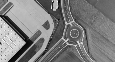
Drone flights are scheduled for October and November. These flights will all be logged and tracked using the Droneradar application. During these flights, specialized experts will be measuring the signals transmitted by the unmanned aircraft. This will enable them to accurately pinpoint the drones’ locations in three-dimensional space and identify any objects that exceed a height of 25 meters, such as buildings, masts, utility poles, and trees.
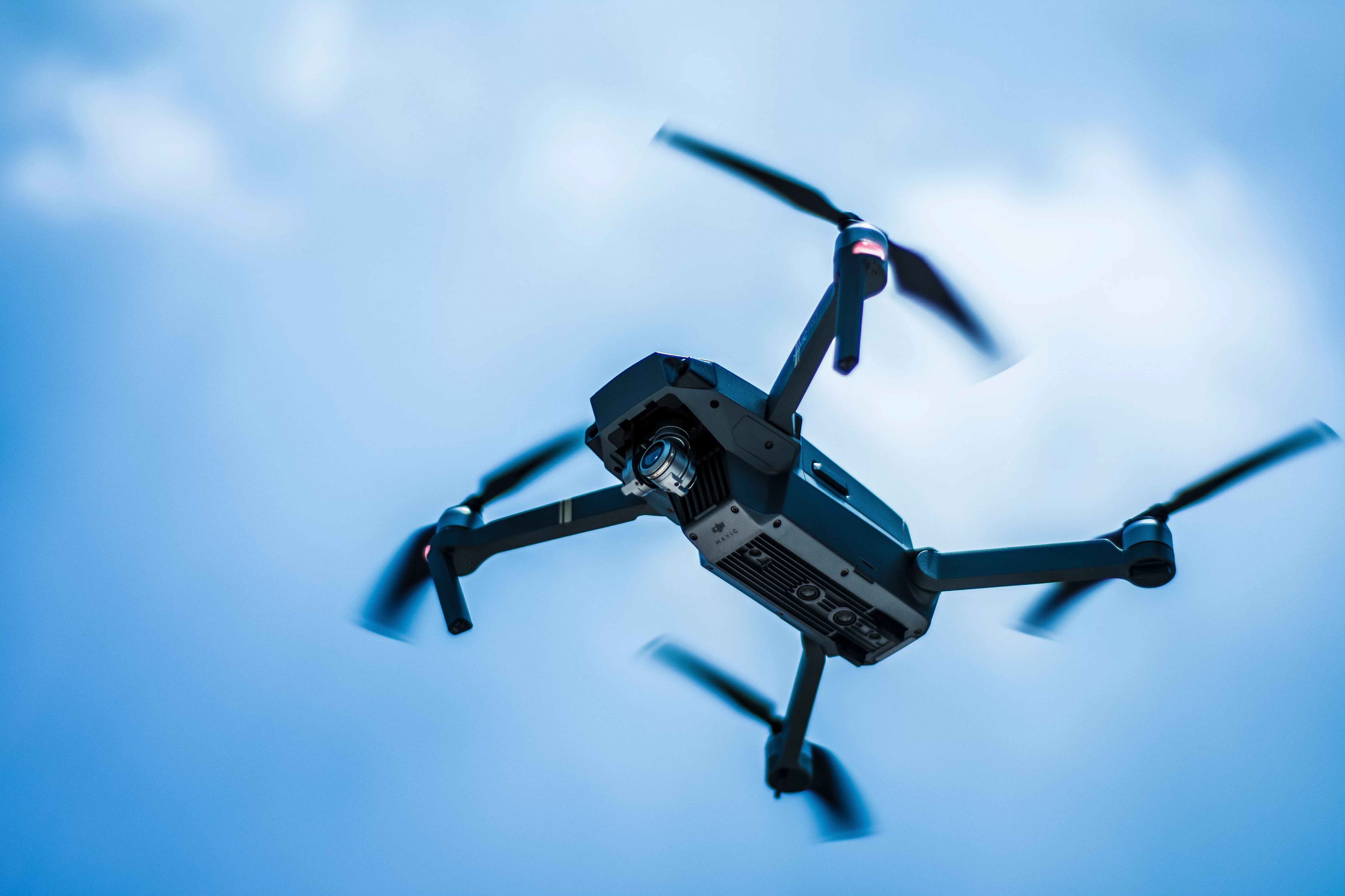
The contractor responsible for the flights has applied for up to 6 unmanned aircraft, but typically, 4 devices will operate simultaneously. The flights will follow a grid pattern with 100-meter spacing, covering a square area of 1 km on each side. In the future, some areas will see flights conducted along a 20-meter grid. Additionally, measurement flights will be conducted around obstacles taller than 25 meters, such as telecommunication masts. The specific unmanned aircraft models registered for these area surveys are the Mavic and Phantom 4 Pro RTK, both of which have dimensions smaller than 1 meter.
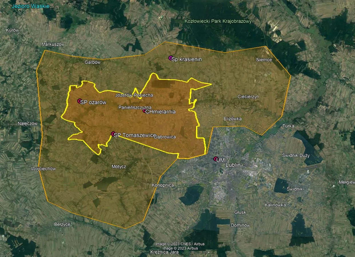
The project area encompasses a total of 120 square kilometres, including the northwestern part of the City of Lublin and nearly the entire area of the Municipality of Jastków. In Lublin, this includes the northern part of the Szerokie district and almost the entire Sławink and Sławina areas. As shown on the attached map, for the first 25 days, flights will take place in the primary area, followed by the extended area afterwards. This area will be equipped in the future with devices to collect information about the positions of unmanned aerial vehicles, enabling the acquisition of various data to support flight safety processes. Consequently, both municipalities will have a tangible influence on regulating drone traffic in their areas, and their users will have access to a comprehensive flight planning system with tools for risk assessment and spatial restrictions concerning other unmanned aircraft.
Financial support for a digital revolution in drone services
![]()
![]()
The development timeline for this project spans from 2022 to 2028 and is part of the larger project titled “Digital Services for Unmanned Aerial Vehicles.” Funding for this project is provided by the European Union as part of the Digital Poland Operational Program for the years 2014-2020. For more detailed information about the project, please visit the lublin.eu website.