Lublin Info Centre
Lublin with Smart City Award
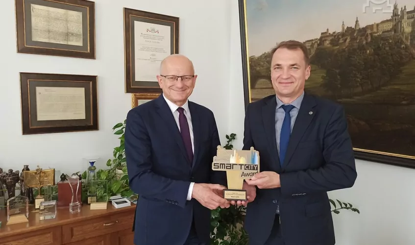
The 3D model created for the needs of Lublin is the next step of building our smart city and it can be used in both participatory and development activities. For years we have been working to make Lublin a smart city and, thus, become more attractive to residents and investors. This award is a confirmation that we are going in the right direction, says Mayor of Lublin Krzysztof Żuk.
The Smart City Contest highlights individuals and initiatives which significantly contribute to building smart cities in Poland. The awards were granted to representatives of businesses and local administration authorities which, through their projects that apply innovative solutions and management strategies, boost the competitiveness of Polish cities, companies and economy.
Lublin was awarded for the implementation of a comprehensive 3D model in the international CityGML standard, which is used by Berlin and Helsinki, among others. It provides three-dimensional visualisations of objects, the city’s terrain, green layers and spatial phenomena. It also enables the creation of various 3D analyses together with thematic studies. The 3D portal offers the possibility to visualise various analyses, including those related to the environment, such as the representation of the solar potential of buildings or the visualisation of noise distribution from the acoustic map in three-dimensional space. A green layer in the form of LiDAR point cloud is also published. Since the 3D model is created as an object model, the results of the analyses, which originate from different field applications, can be integrated and exported to applications that allow for urban planning analyses. The portal was created in a technology that allows automatic adjustment of the view to the type of a browser and device (computer, tablet, phone). It has built-in mechanisms for recording the history of changes to building models.
The project lasted six months (from September 2019 to February 2020) and included the integration of the existing 2D geoportal with 3D data. A contract to execute the project was awarded to SHH Wrocław. The model was based on data from the Centre for Spatial Analysis of Public Administration (CAPAP) and the Land and Property Registry (EGiB), which made it possible to obtain a georeferencing of the objects, i.e. their position in digital space in accordance with geodetic data. The Lublin model was developed in detail allowing for distinguishing between block models that reflect the general shape of buildings and the geometry and shape of roofs.
The 3D model of Lublin is used in investment processes and public consultations together with the 2D mapping tools that are currently in use. Thus, the process of designing new buildings becomes more transparent and the stakeholders gain knowledge about possible impacts new buildings may have on the nearest and distant neighbourhood.
The model is available at www.lublin3d.lublin.eu.
About the Smart City Forum
The Smart City Forum is the biggest congress dedicated to the functioning and development of smart cities. It is a platform for the exchange of experience between representatives of public administration, CEOs, business leaders and foreign experts, who present innovative solutions used in cities like Barcelona, Singapore or Toronto.